
Correct altitude (geoid correc
5 ming+
Yuklanmalar

3+
info
Bu ilova haqida
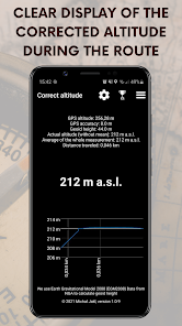
GPS uses a simplified smooth Earth surface called ellipsoid for positioning, including altitude. However, the planet is not smooth and therefore the difference between the actual user altitude and the GPS altitude can make many tens of meters!
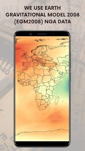
We use Earth Gravitational Model 2008 (EGM2008) NGA data to calculate the geoid deviation from the ellipsoid surface for any location on the Earth's surface. All database is stored directly in the application and so the whole system works without the need for an Internet connection.
You can set some other values such as sensitivity and averaging steps to get even more accurate results that you see in a clear graph in real time.
More precisely than with this app under normal conditions you will not find your mobile altitude!
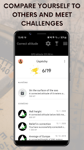
Collect achievements, follow the leaderboards! Every meter counts! :)
We use Earth Gravitational Model 2008 (EGM2008) NGA data to calculate the geoid deviation from the ellipsoid surface for any location on the Earth's surface. All database is stored directly in the application and so the whole system works without the need for an Internet connection.
You can set some other values such as sensitivity and averaging steps to get even more accurate results that you see in a clear graph in real time.
More precisely than with this app under normal conditions you will not find your mobile altitude!
Collect achievements, follow the leaderboards! Every meter counts! :)
Oxirgi yangilanish
Xavfsizlik — dastur ishlab chiquvchilar maʼlumotlaringizni qanday jamlashi va ulashishini tushunishdan boshlanadi. Maʼlumotlar maxfiyligi va xavfsizlik amaliyotlari ilovadan foydalanish, hudud va yoshga qarab farq qilishi mumkin. Bu axborot dastur ishlab chiquvchi tomonidan taqdim etilgan va keyinchalik yangilanishi mumkin.

Tashqi hamkorlarga hech qanday axborot ulashilmagan
Dastur ishlab chiquvchilar axborot ulashilishini qanday aytishi haqida batafsil

Ushbu ilova quyidagi axborot turlarini toʻplashi mumkin
Joylashuv

Maʼlumotlar uzatish vaqtida shifrlanadi

Maʼlumotlar oʻchmaydi
Ilova yuzasidan yordam
Dasturchi haqida

