
ArcGIS Field Maps
4,2star
1,52K reviewsinfo
1M+
Downloads

PEGI 3
info


About this app
ArcGIS Field Maps is Esri’s premier maps app on mobile devices. Use Field Maps to explore the maps you make in ArcGIS, collect and update your authoritative data, and record where you’ve gone, all within a single location-aware app.
Key Features:
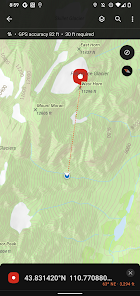
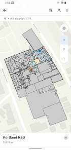
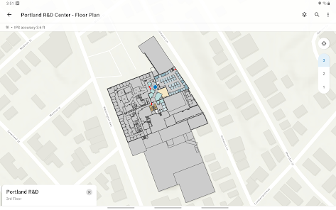
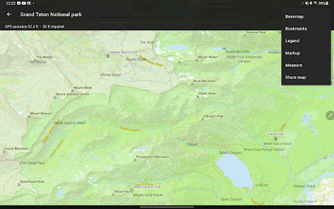
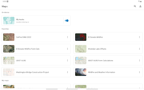
- View high quality maps created using ArcGIS.
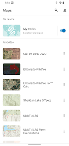
- Download maps to your device and work offline.
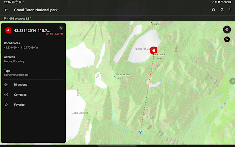
- Search for features, coordinates, and places.
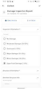
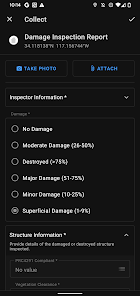
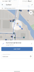
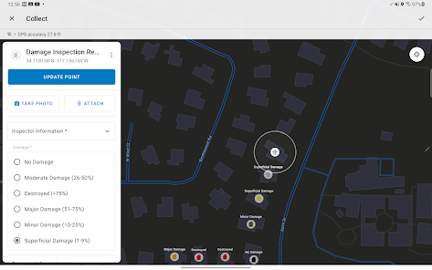
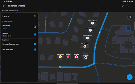
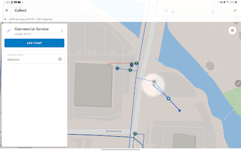
- Collect points, lines, areas, and related data.
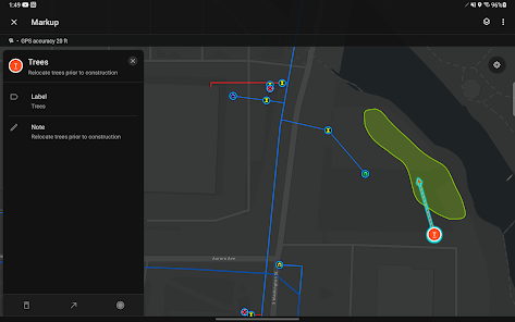
- Mark up maps for your own use or to share with others.
- Use professional-grade GPS receivers.
- Collect and update data using the map or GPS (even in the background).
- Fill out easy-to-use, map-driven smart forms.
- Attach photos and videos to your features.
- Record where you've been and share your location.
- Streamline field workflows by integrating with other apps on your device.
Note: This app requires you have an ArcGIS organizational account to collect and update data.
Key Features:
- View high quality maps created using ArcGIS.
- Download maps to your device and work offline.
- Search for features, coordinates, and places.
- Collect points, lines, areas, and related data.
- Mark up maps for your own use or to share with others.
- Use professional-grade GPS receivers.
- Collect and update data using the map or GPS (even in the background).
- Fill out easy-to-use, map-driven smart forms.
- Attach photos and videos to your features.
- Record where you've been and share your location.
- Streamline field workflows by integrating with other apps on your device.
Note: This app requires you have an ArcGIS organizational account to collect and update data.
Updated on
Safety starts with understanding how developers collect and share your data. Data privacy and security practices may vary based on your use, region and age. The developer provided this information and may update it over time.

No data shared with third parties
Learn more about how developers declare sharing

This app may collect these data types
Location, Personal info and 4 others

Data is encrypted in transit

Data can’t be deleted
Ratings and reviews
4,1
1,41K reviews

Damian Horn
- Flag inappropriate
01 October 2025
Latest version has DESTROYED the markup feature - why would you cripple such an important tool??? It has now been changed to 'Personal Markup' and there is no longer the ability to have multiple markup layers, create straight lines / arrows, drop pins, clear entire markups, export or share markup layers to other users. This change will create hours of unnecessary work. Edit: And now crashes / force closes every few actions despite uninstall / clear data / reinstall. Unsafe to rely on in field.
5 people found this review helpful
Esri
04 October 2025
Hi Damian. We'd like to hear how you are using markup to complete work today. We'd like to better understand how you were using markup layers and sharing with other users. We're also working hard on some specific regressions that you may have encountered. Please reach out to [email protected] so we can work directly with you!

Jasper Dillberry
- Flag inappropriate
- Show review history
05 October 2025
Another fine mess you've made ESRI. Latest version is not operable by many users but as yet ESRI has not acknowledged the problem or made a move to mitigate the problem. All ESRI products have more bugs than a Kings Cross backpackers but ESRI just charges on leaving most of their issues unresolved.
Esri
06 October 2025
Thanks for posting Jasper. We value your feedback and sorry you have encountered issues. If you'd like to contact us directly, email [email protected]. Also please report your specific issues to Esri Support so we can make sure they are addressed in a timely fashion.

nicholas fuerst
- Flag inappropriate
07 October 2025
It crashes and glitches to the point that I can't use my phone for the project. Prior to the update, there were almost no issues.
Esri
08 October 2025
Hi Nicholas. Sorry for the disruption we have caused. Please reach out to Esri support or email [email protected] so we can identify the specific issues you are having and get you turned back around.
What's new
- Various bug fixes and improvements.
App support
About the developer
ESRI ONLINE LLC
380 New York St
Redlands, CA 92373-8118
United States
+1 909-369-9835


